Dreilander MTB Tour
Elevation and data
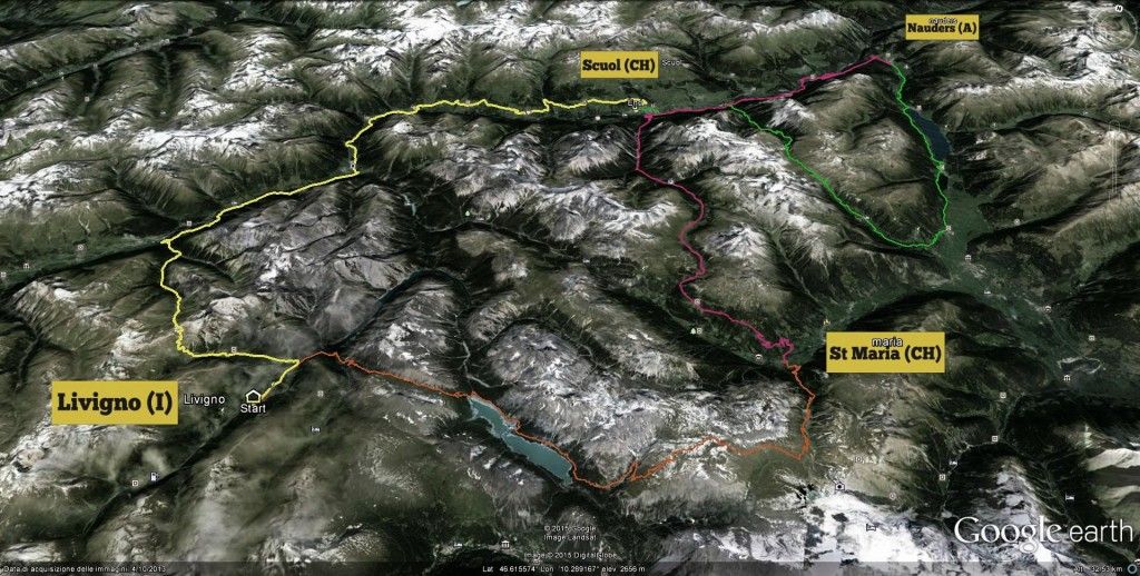
The Dreilander Tour is available in 2 version, the A version is the toughest, it is raccomanded for biker with a good shape, of course you have not to be a Superman or a Supergirl but the elevation and lenght data talk straight. 6743 meters elevation and 198 km in 4 days. Of course you can decide every day if you prefear to do the tough one or the easy one stage becouse starting and arrival point are ever the same.
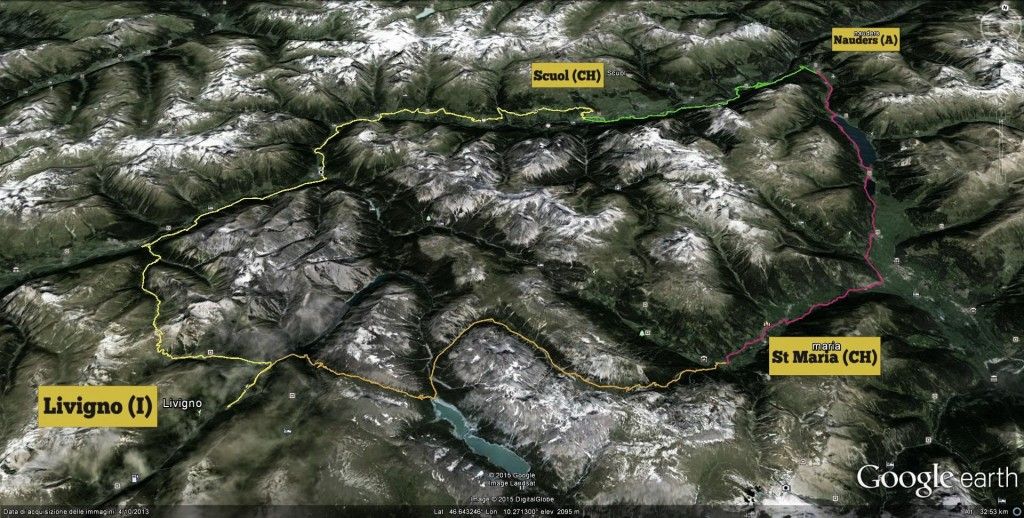
The Tour B is the easy version of the Dreilander Tour, easy means not “EASY” anyhow is not the right tour for lazy or clueless bikers. You have to ride 168 km and climb 5250 meters in 4 days bur of course it is more accessible then the A version.
Weather condition are also important, if you ride your Dreilander Tour in sunny days it will be different then ride a stage with rain or cold wind.
If you need advice about effort and difficulties call us.
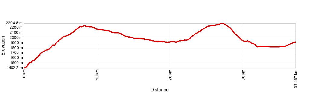
Tour A Map
Tour B Map
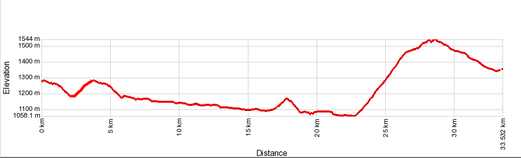
Day 1 – Livigno (Italy) – Scuol (Switzerland)
*same path A and B
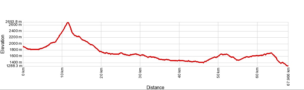
Livigno – Chaschauna – Zernez – Susch – Lavin – Guarda – Ardez – F’tan – Scuol.
- Distance: 67.9 km
- Ascent: 1533 m
- Difficulty: difficult
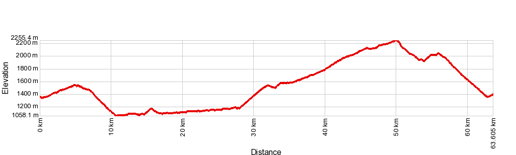
Day 2 – Scuol (Switzerland) – Nauders (Austria)
Tour A
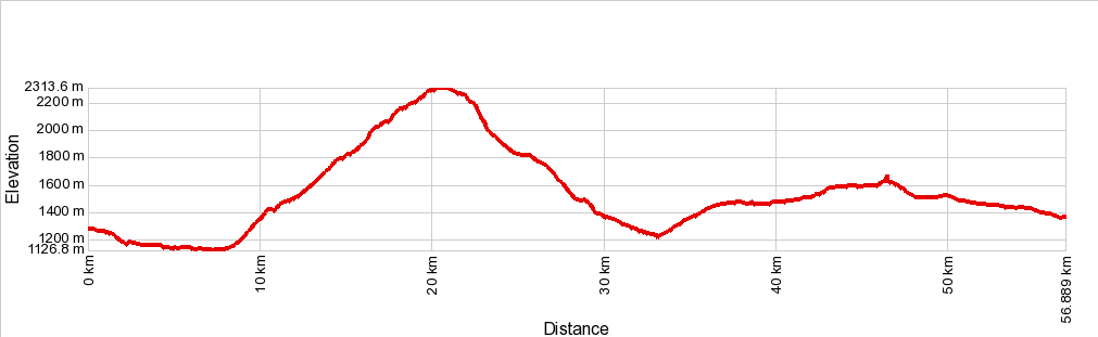
Scuol – Sur En – Galleria Val d’Uina – Sesvenna – Schlinig – Burgeis – Reschensee – Nauders.
- Distance: 56.8 km
- Ascent: 1778 m
- Difficulty: difficult
TourB
<img src="/images/elevation/B2.png" alt="B2" />
Scuol – Sur En – Sclamischot – Nauders.
- Distance: 29.9 km
- Ascent: 783 m
- Difficulty: easy
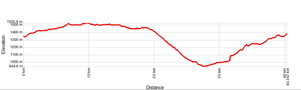
Day 3 – Nauders (Austria) – Santa Maria (Switzerland)
Tour A
Nauders – Sclamischot – Scuol – Pass da Costainas – Sta. Maria.
- Distance: 63.5 km
- Ascent: 1714 m
- Difficulty: medium
Tour B
Nauders – Reschenpass – Sta. Maria
- Distance: 40.3 km
- Ascent: 695 m
- Difficulty: easy
Day 4 – Santa Maria (Switzerland) – Livigno (Italy)
Tour A
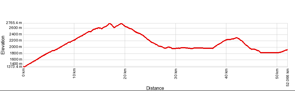
Sta.Maria- Boccheta di Forcola – Passo Alpisella – Livigno
- Distance: 52.0 km
- Ascent: 1906 m
- Difficulty: difficult
Tour B
St.Maria – Val Mora – Cancano – Alpisella – Livigno
- Distance: 37.0 km
- Ascent: 1361 m
- Difficulty: medium